Storm Chasing
Storm Chaser Ben Holcomb
Bio
As a resident of Oklahoma, Storm Chaser Ben Holcomb is centrally located in the heart of tornado alley. Each spring he travels thousands of miles in pursuit of severe and unusual weather. While a good day of structure or big hail is exciting, nothing compares to the grand prize of storm chasers: the Tornado. To date, Ben has witnessed approximately 200 tornadoes.

Ben Holcomb spent the first 25 years of his life in Lansing, Michigan where he became fascinated with severe weather. While he ultimately chose a career in Information Technology, he has still managed to tie it in with weather. Ben learned all of his meteorological knowledge through internet research and experience. He has no formal weather education.
In 2007, Ben began chasing storms outside of Michigan. He also became involved with bringing live video streaming technology from storm chasers to the public. This merging of weather and technology lead him to move to Oklahoma in 2010. Ben worked for a private weather company before spending time at OU Meteorology as an IT Professional.

Contributions
Ben has worked with numerous media outlets from local TV stations to national news networks and had his storm chaser video shown worldwide. He helped put together the SPC Video Lecture Series and the Tornado Forecasting Workshop while working at The University of Oklahoma. Ben was a member of RACES in the Lansing area and ran the county Skywarn program. Ben has also assisted with international weather installations in Thailand, Indonesia, and Dubai.
Storm Chaser Ben Holcomb Track Map
This map utilizes my last known SpotterNetwork location. The map updates locations automatically when I am active.
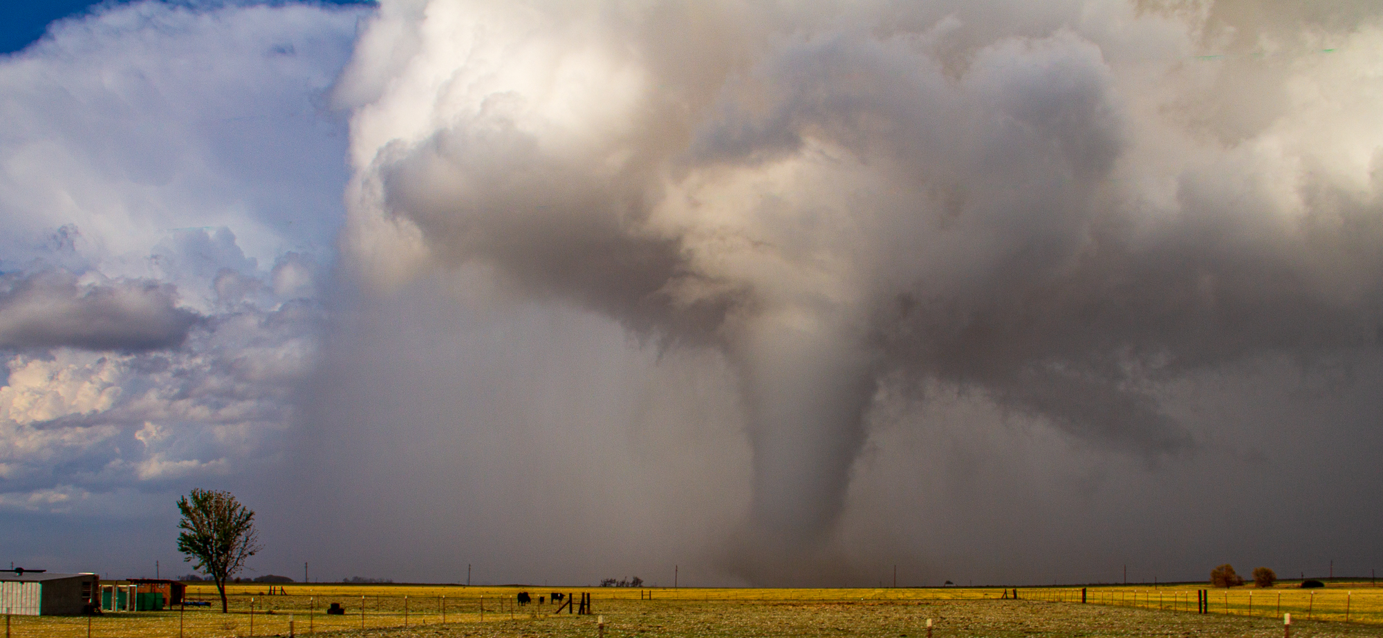
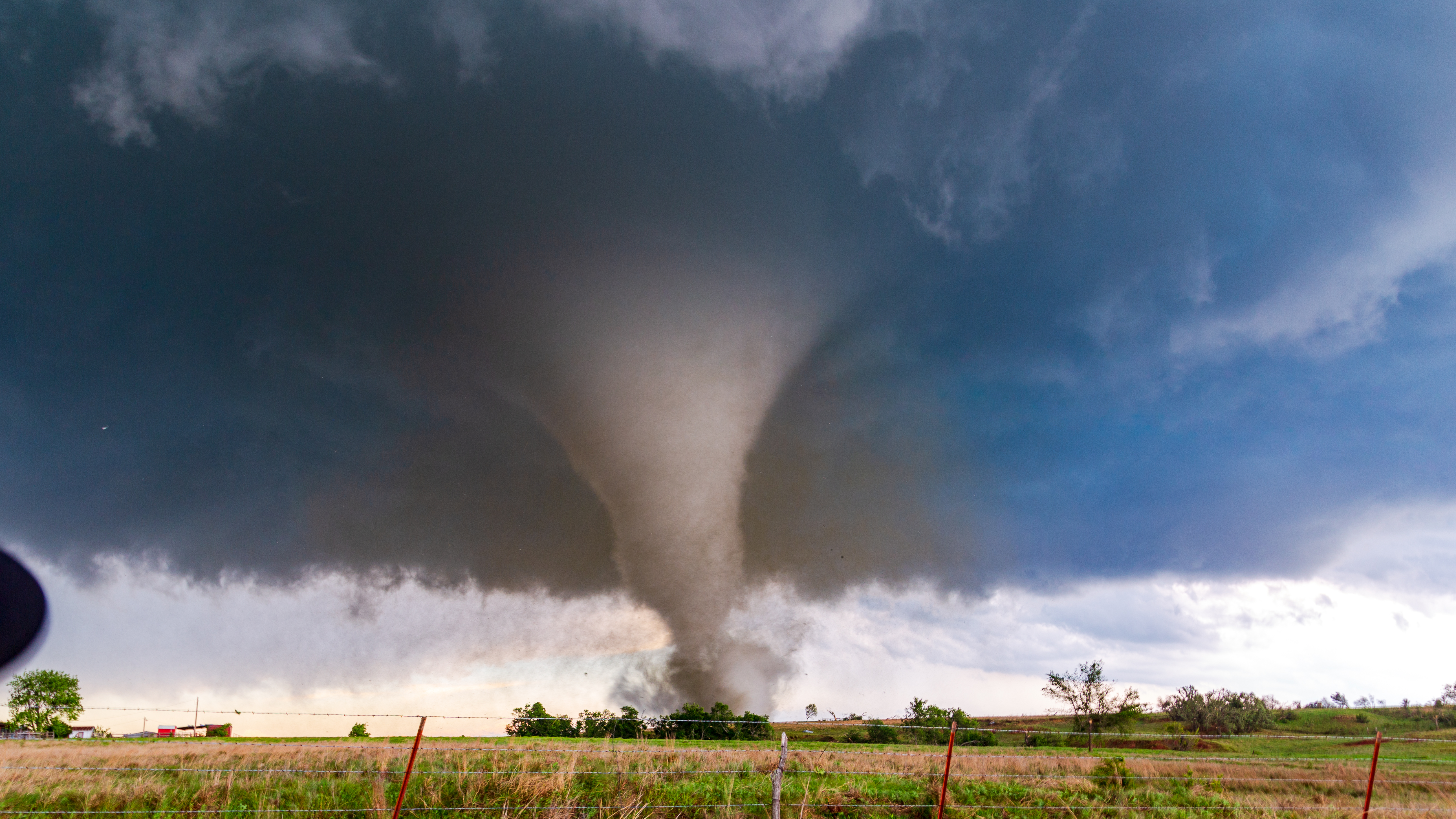
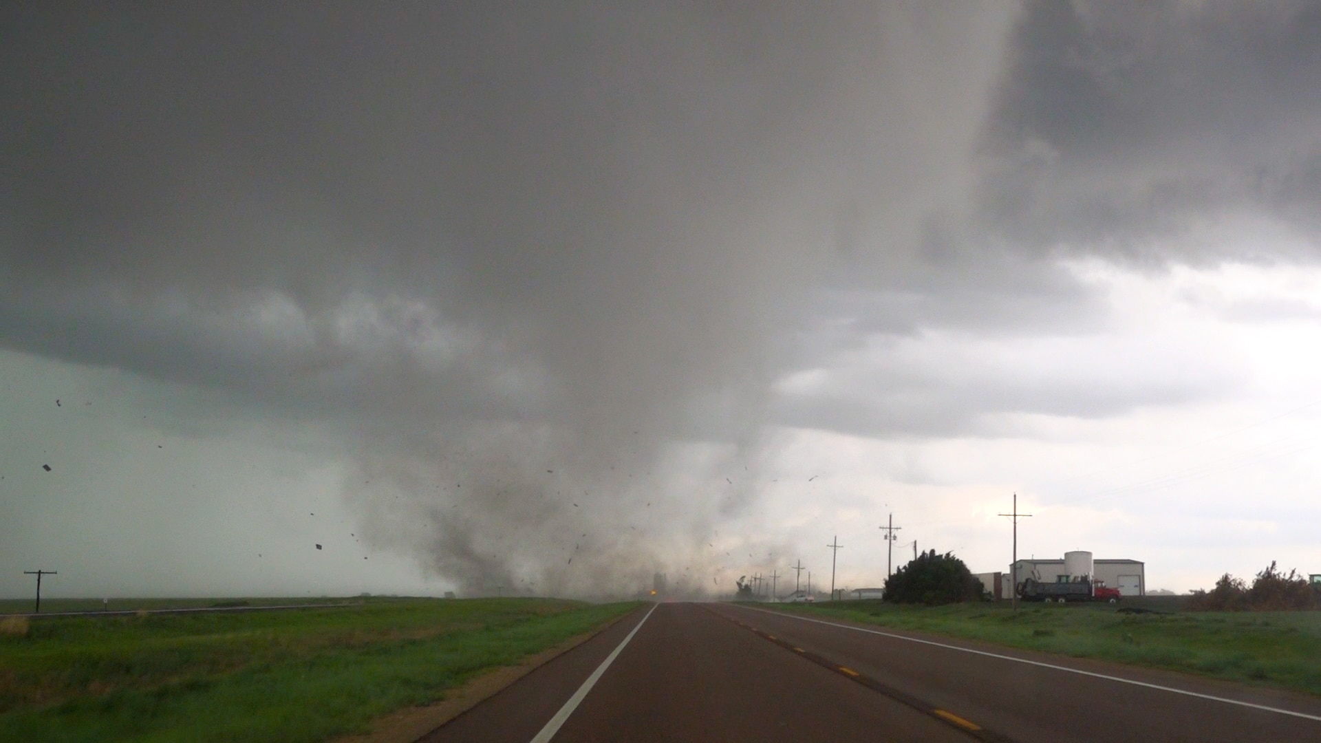
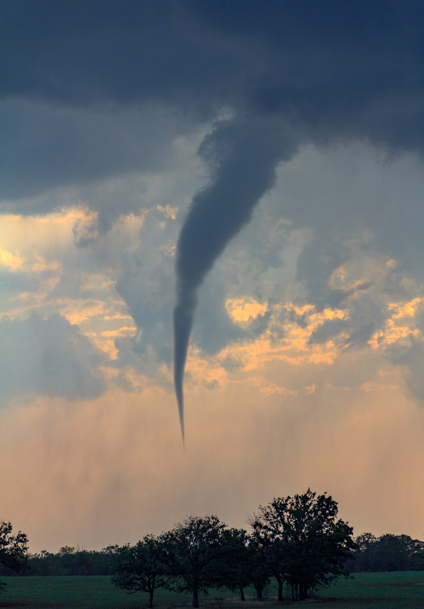
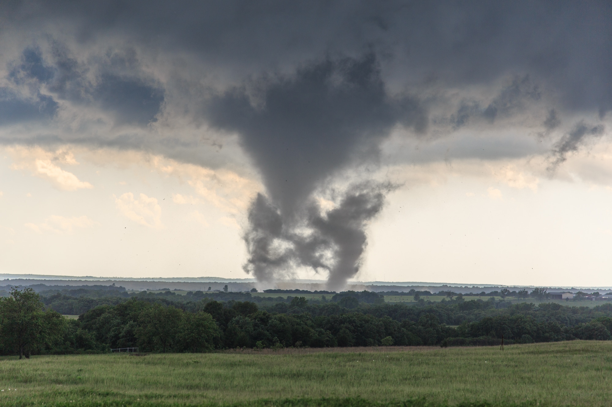
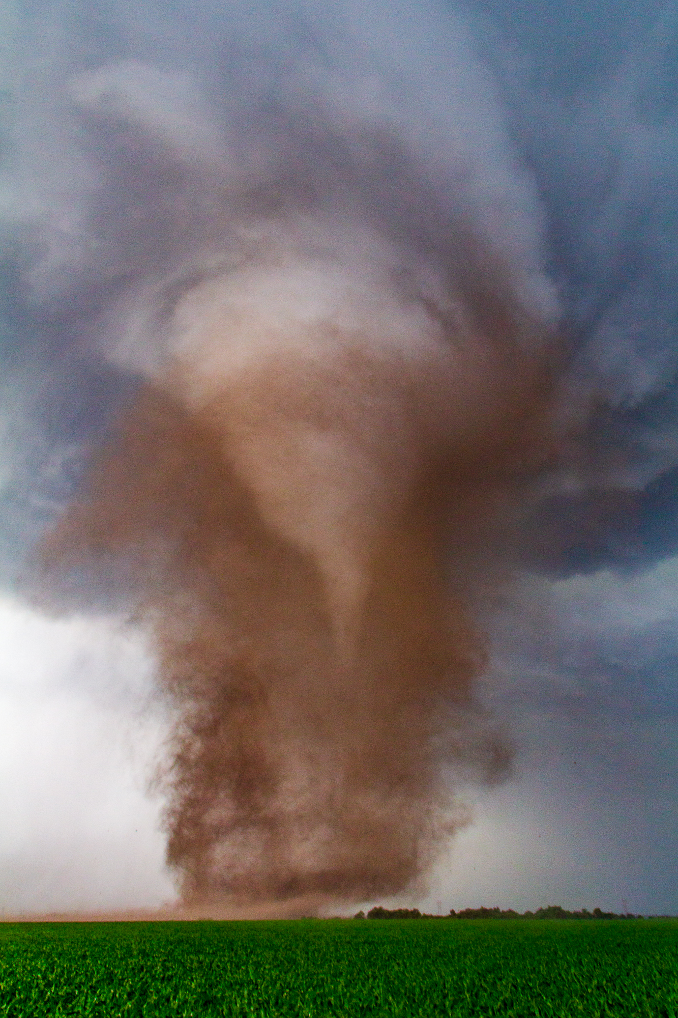
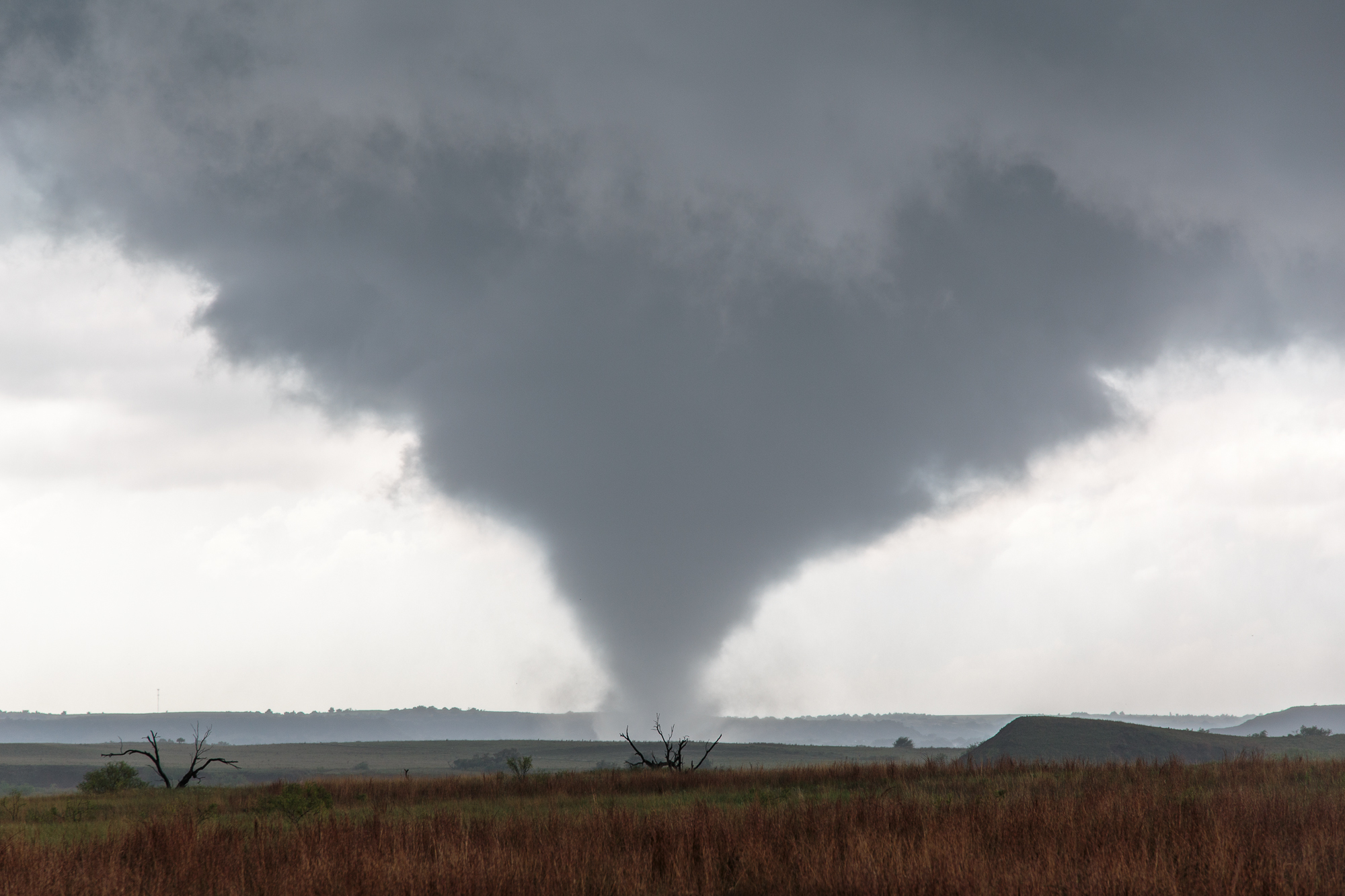
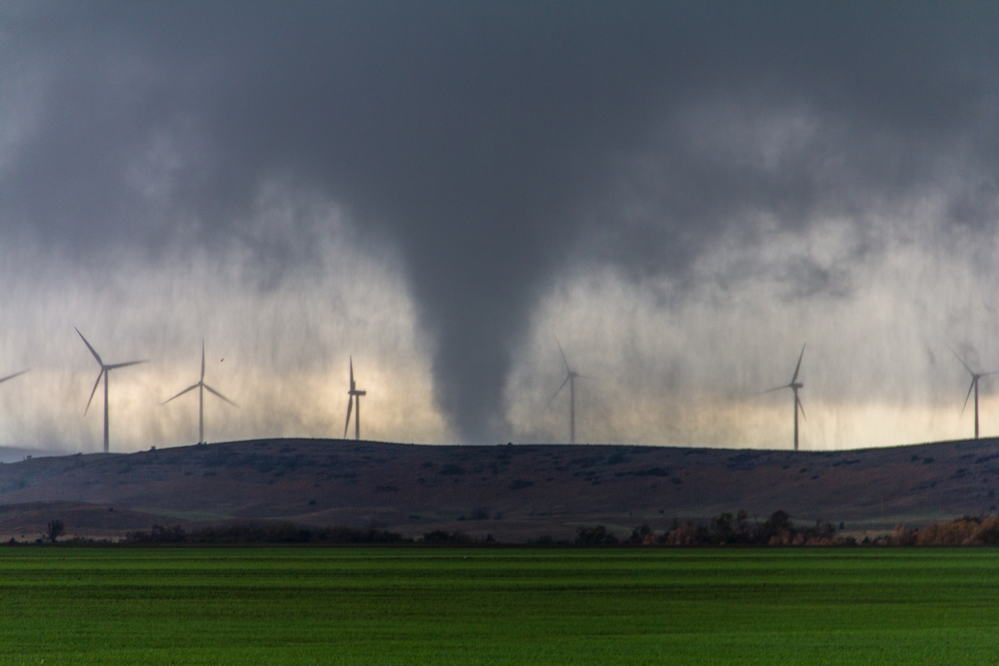
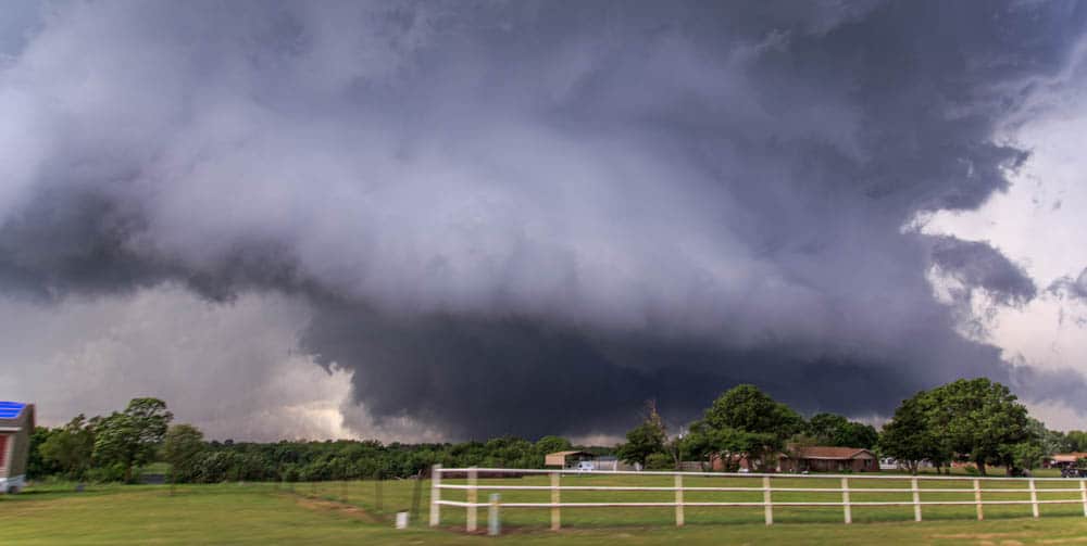
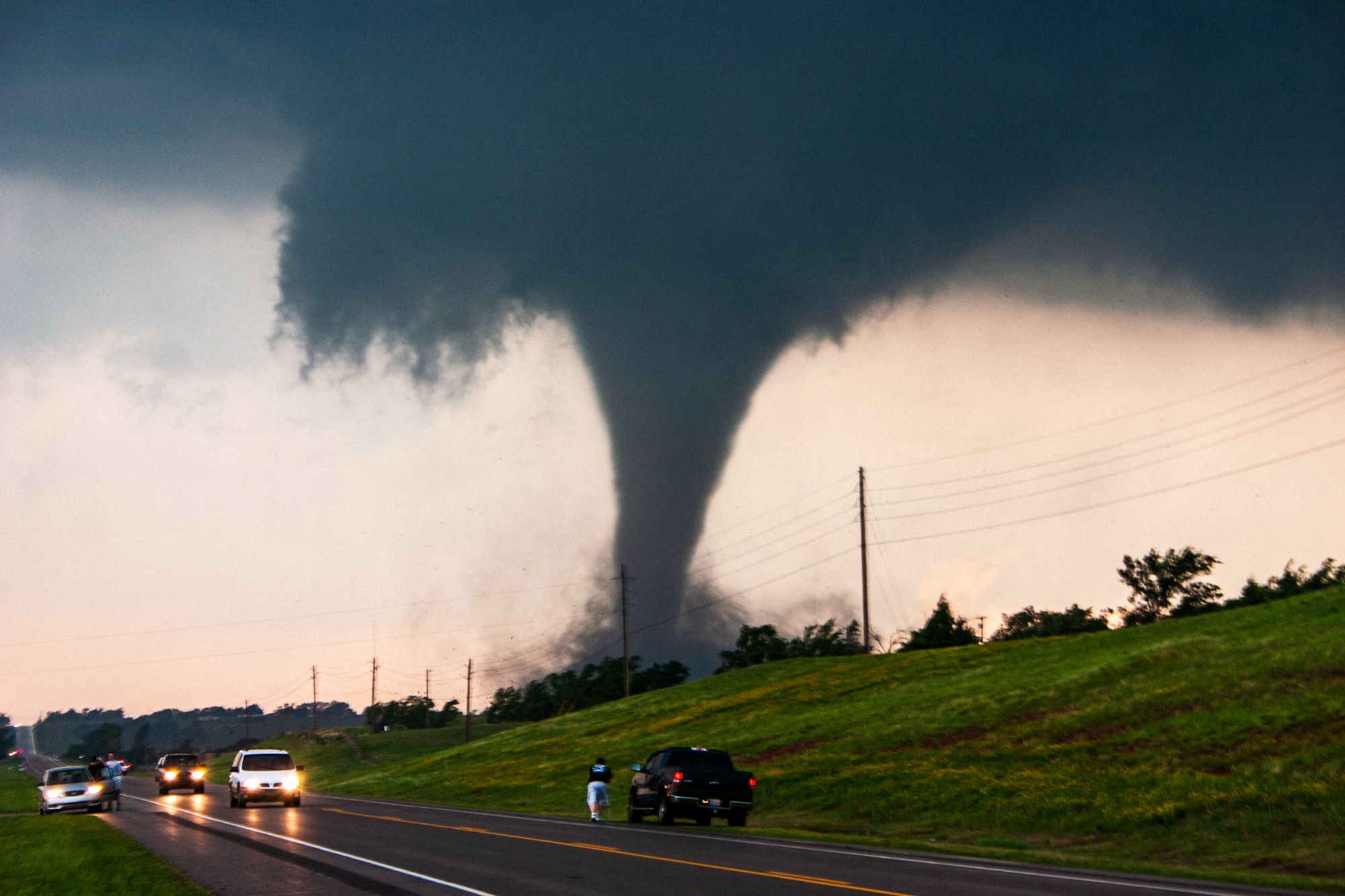
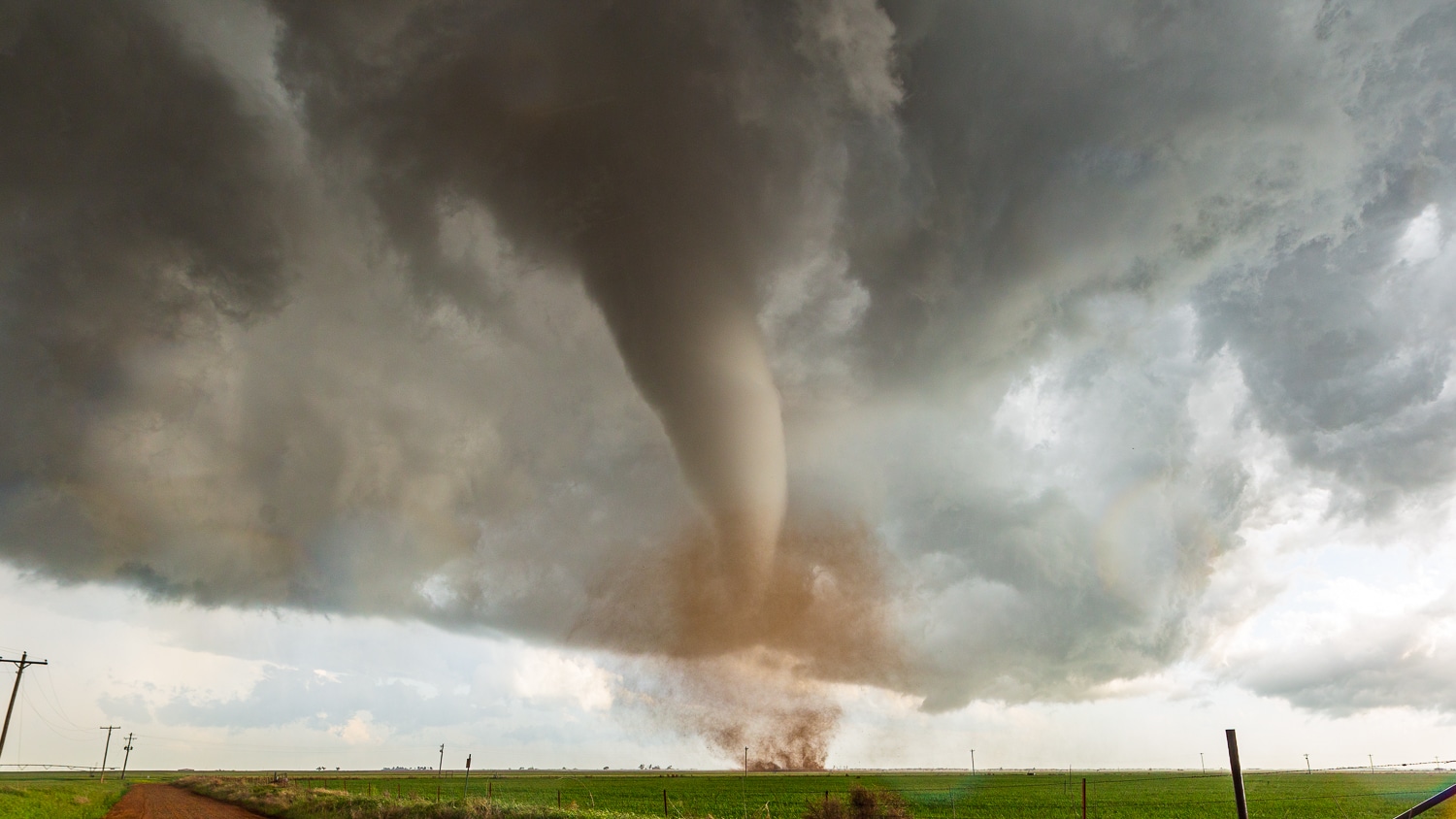
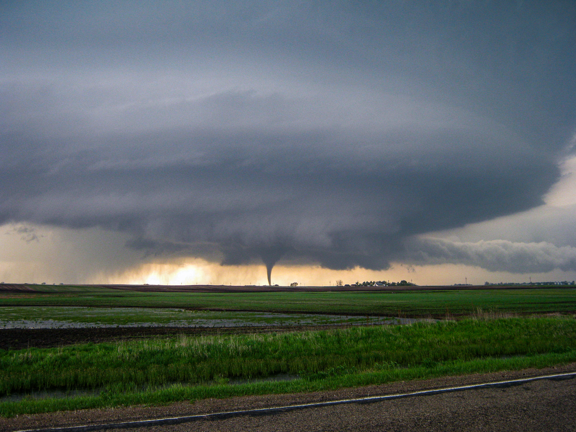
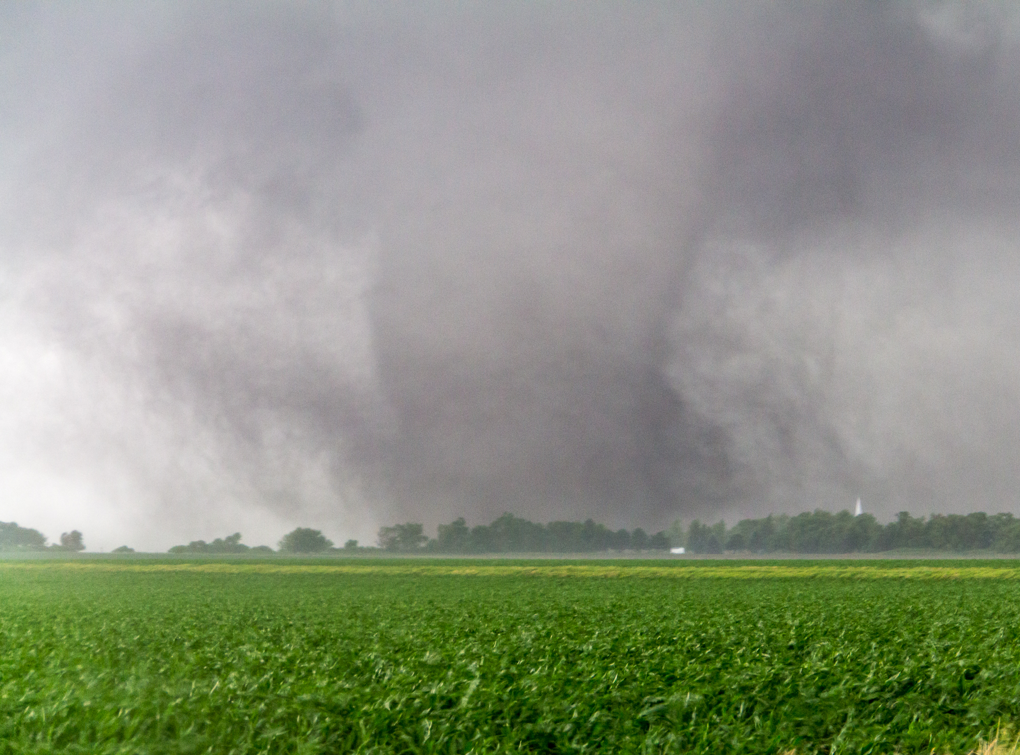
Featured Tornado Photos


Latest Chases
- April 1, 2024 - A moderate risk on April Fools day that failed to materialize (321 Miles)
- March 24, 2024 - A funnel near Hammon Oklahoma on a moisture starved early season chase (458 Miles)
- September 23, 2023 - A Fall Saturday chase in Eastern Oklahoma provides some good storms and lightning. (274 Miles)
- June 25, 2023 - On a supercell near Indianapolis that becomes outflowy and evaporates while a nearby storm produces a beautiful tornado. (1692 Miles)
- June 21, 2023 - Strong tornado hits the town of Matador, Texas (737 Miles)
- June 17, 2023 - Beautifully structured supercell tracks from near Pampa to Roger Mills County in Western Oklahoma (579 Miles)
- June 15, 2023 - In proximity of a tornado near Loco, OK (387 Miles)
- May 26, 2023 - Sat in Roswell most of the day before heading south to a supercell near Orla, TX (1065 Miles)
- May 24, 2023 - After targeting near Lubbock, we ended up on a supercell near Roswell at sunset (582 Miles)
- May 13, 2023 - A brief tornado develops in an early day supercell near Chickasha Airport (139 Miles)
- May 12, 2023 - Supercell fires near Chickasha and tracks across Grady County while struggling to sustain. (113 Miles)
- May 11, 2023 - Multiple tornadoes in Central Oklahoma (261 Miles)
- May 4, 2023 - Chased a supercell from Windthorst to Bowie, TX (372 Miles)
- April 26, 2023 - An intense supercell tracks from Meridian, TX through Waco and southeast (680 Miles)
- April 25, 2023 - Blue Sky Bust in Lawton (185 Miles)
- April 19, 2023 - Multiple Supercells with tornadoes in Central Oklahoma (191 Miles)
- April 2, 2023 - Supercells with hail down near Dublin and Stephenville Texas (606 Miles)
- March 2, 2023 - Intense supercell in southeast Oklahoma near Hugo. (404 Miles)
- February 26, 2023 - Storms moving at 70 MPH from the Texas Panhandle. Night ended with a tornado near my house in Norman. (460 Miles)
- November 29, 2022 - Moderate risk 15% hatched bust in late November in Dixie (1164 Miles)
- May 30, 2022 - Started off near a moderate risk/15% hatched tornado risk in Sioux City and chased supercells in southern Kansas (648 Miles)
- May 29, 2022 - A potentially potent day in Northeastern Nebraska in a showdown with the cap. The cap won. (709 Miles)
- May 24, 2022 - Bust down near Brownwood in Central Texas. Outflow storm modes dominate. (624 Miles)
- May 12, 2022 - 80-90 MPH Straight line winds in a fast moving Derecho near Huron, SD (1585 Miles)
- May 4, 2022 - Multiple tornadoes including wedges in Eastern Oklahoma. Witnessed the Seminole Oklahoma Tornado (342 Miles)