Storm Chase Details
Miles Logged: 129
States Chased: OK
Severe Risks: SPC Outlooks
Severe Reports: Storm Reports
What looked like it could be a good day turned into a pretty mediocre overall day, with a supercell tracking through Oklahoma City/Moore metro at and shortly after dark.
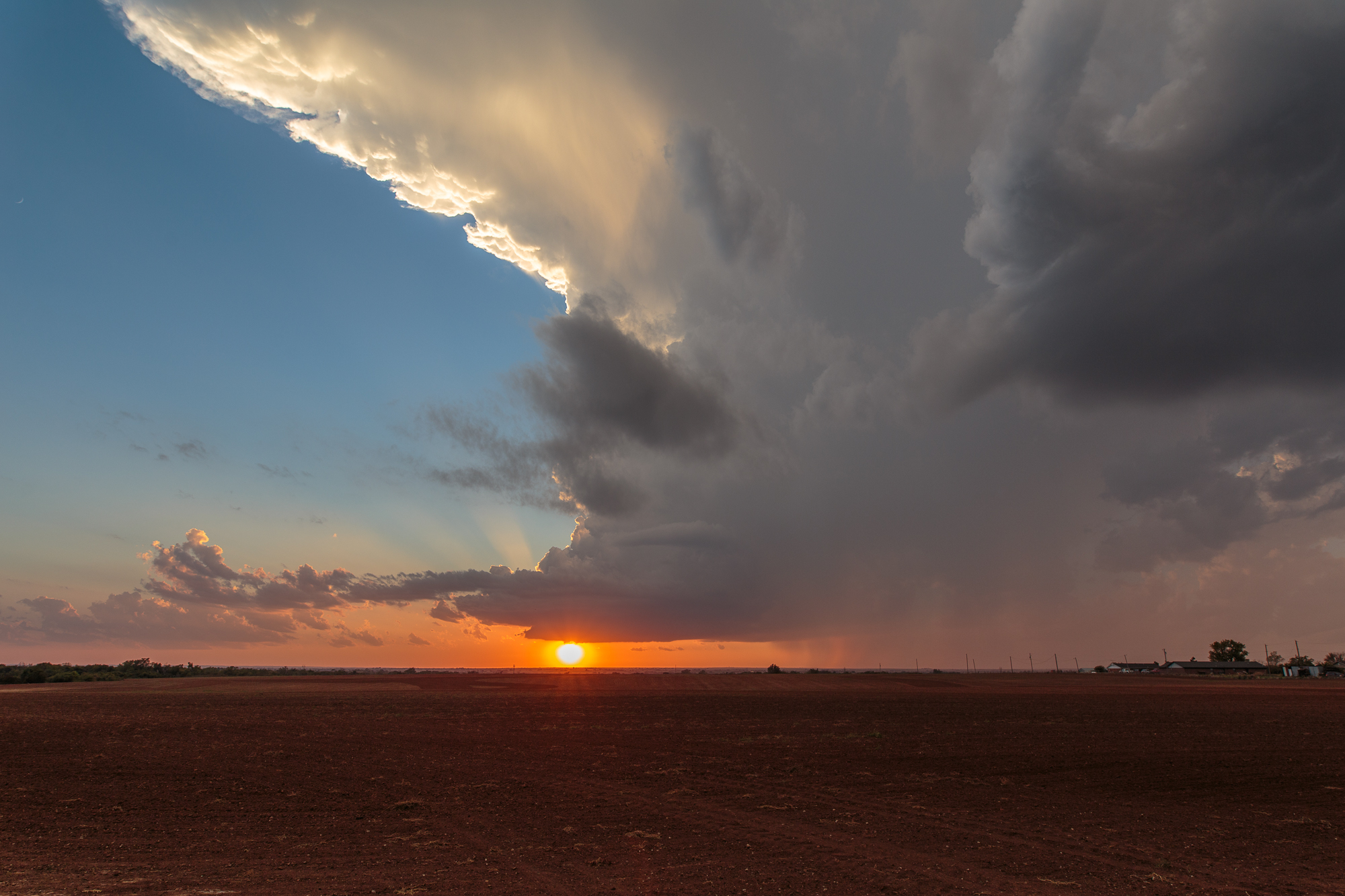
I left Norman and headed to Chickasha, which was along the dryline. It seemed plausible that something would fire, but the bubbling cu seemed to be inhibited. The convergence seemed to be at the DQ in Chickasha, so I joined with a bunch of others. We sat around waiting, watching the CU eventually evaporate, and we started heading back. I decided to take the “scenic” route of US 277 just for the heck of it, since I hadn’t been down that in awhile.
By the time we got to Blanchard, we noticed some blips on radar. Could it be a storm?
Looking out the window, it sure could be. And the roads in Grady County really suck, so we needed to find a way to approach.
I decided going back down to Highway 92 then north was the best way to do it, intercepting the storm along the train tracks on 92 near Amber.
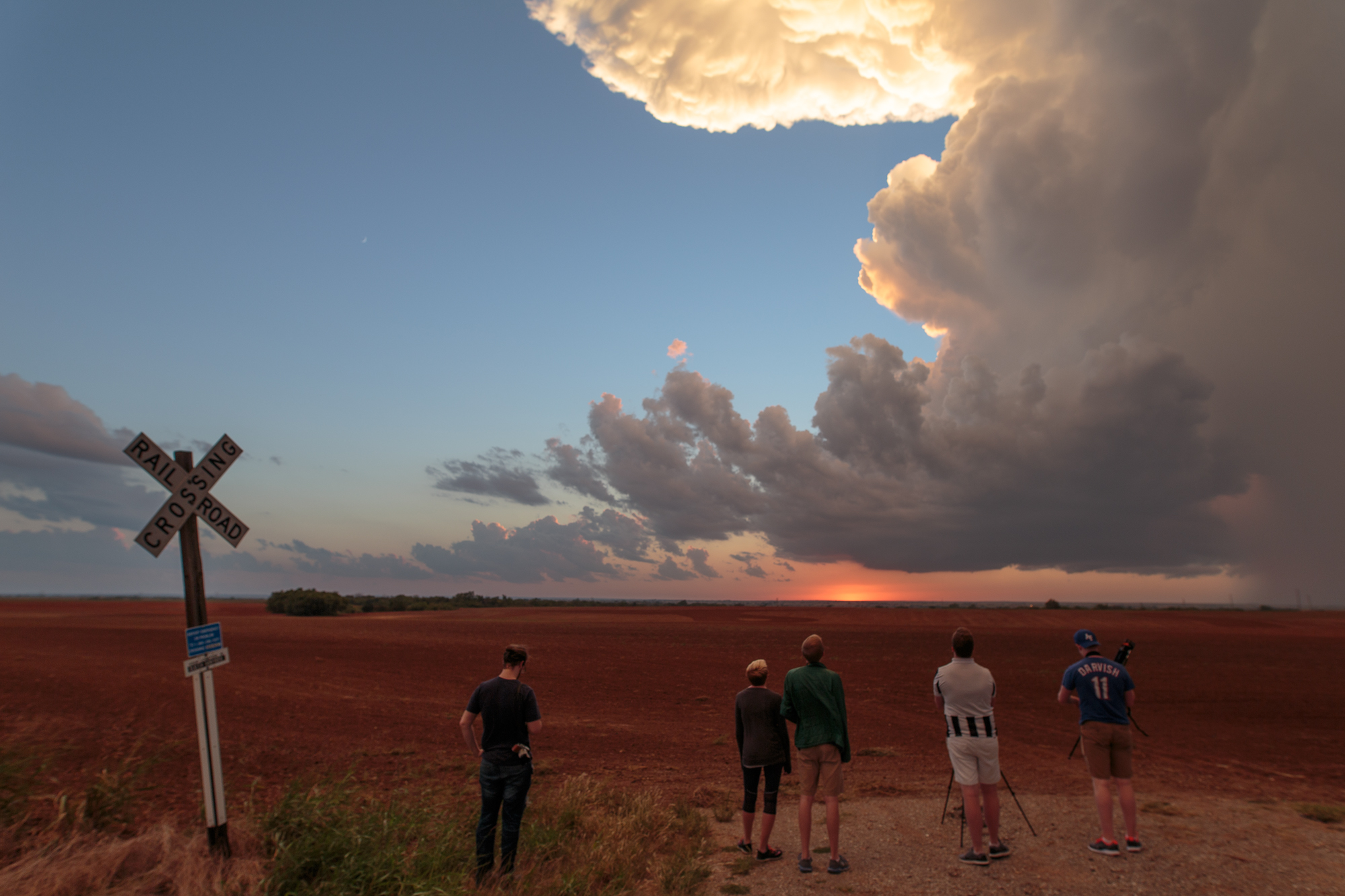
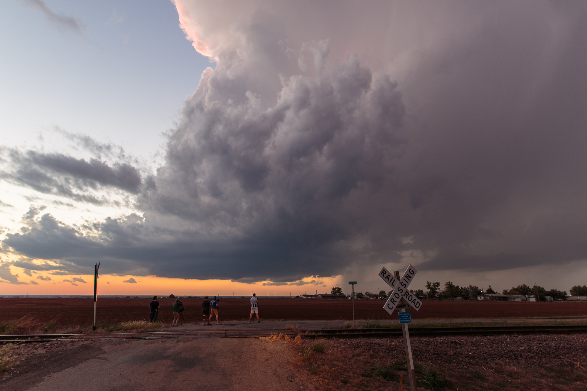
The storm tried to wrap up, but it never seemed to be fully surface based, and never was able to get friction to get fully spinning. It definitely created some nice wall clouds and cone funnels, but we followed that storm through the dark into Tuttle and Moore before giving up near I-35.
It tried. So did we. Bust.


