Storm Chase Details
Miles Logged: 820
States Chased: TX
Tornadoes Witnessed: 3
Largest Hail Encountered: 4.25 in.

Spotter Network Reports: 3
- Tornado 11 miles E of STEPHENVILLE, TX
- Hail 6 miles ENE of GLEN ROSE, TX
- Tornado 10 miles W of RIO VISTA, TX
Severe Reports: Storm Reports
From TX to IL to TX
After driving late into the night and arriving home at around 2am from Illinois, I headed pretty much straight to bed with an expected departure of 9-10am. Getting up early wasn’t easy, but I was sure glad I did it as I got down into Texas early enough to be on one of the initial tornado warned storms.
First Storm
Originally, I targeted along I-20 near Abilene or just east. As I neared Graham, it looked like a storm off to my west near Throckmorton and the storm to the southwest of it were becoming quite organized. They even issued a tornado warning for the storm near Anson.
Luckily storm motions were not nearly as intense as they were on Friday. I was able to make it down in time to chase the storm as it was tornado warned west of Albany, TX.
Dumping the Albany Storm
We watched 2 or 3 cycles of the storm near Albany before realizing it was likely becoming outflow dominant. Meanwhile, the storm to our south was looking amazing visually (anvil) and on radar, so I decided to make the jump down there.
I headed to Cisco then south across I-20 and down to Rising star. The roads kind of screwed me, and I was trying to avoid hail. I chose to take the drop south to Comanche and then northeast towards Dublin.
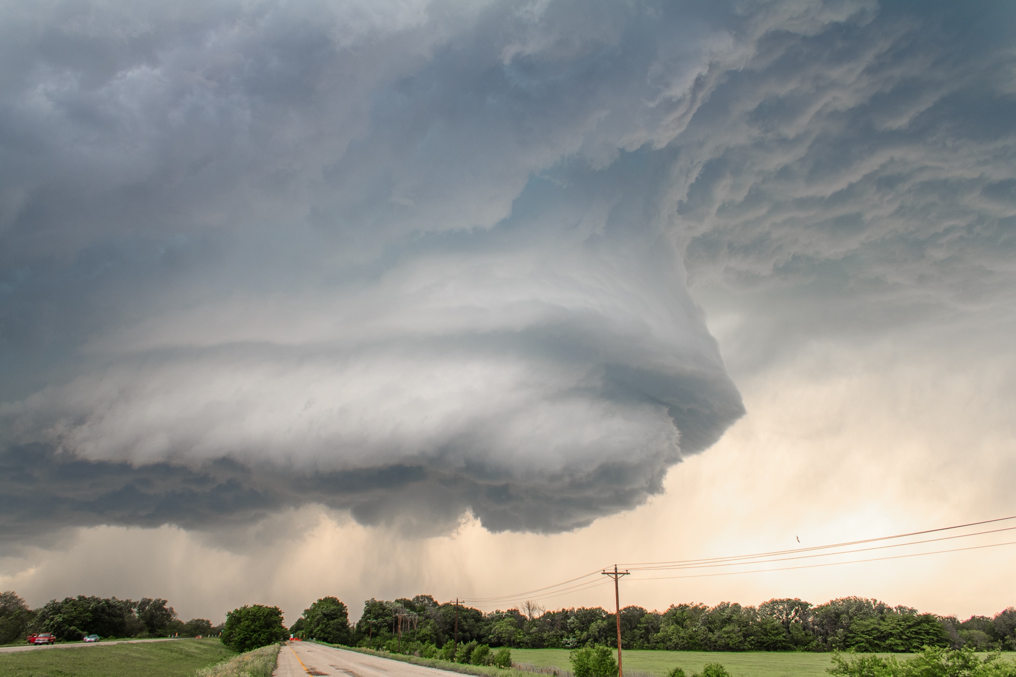
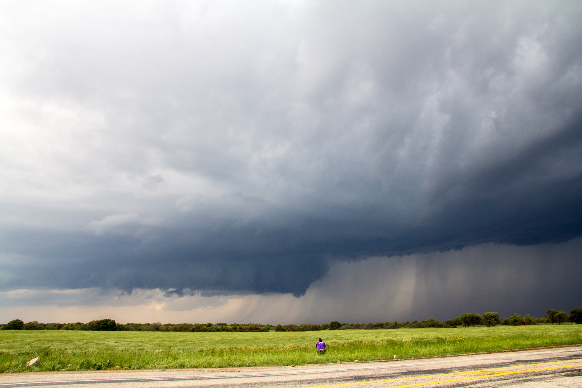
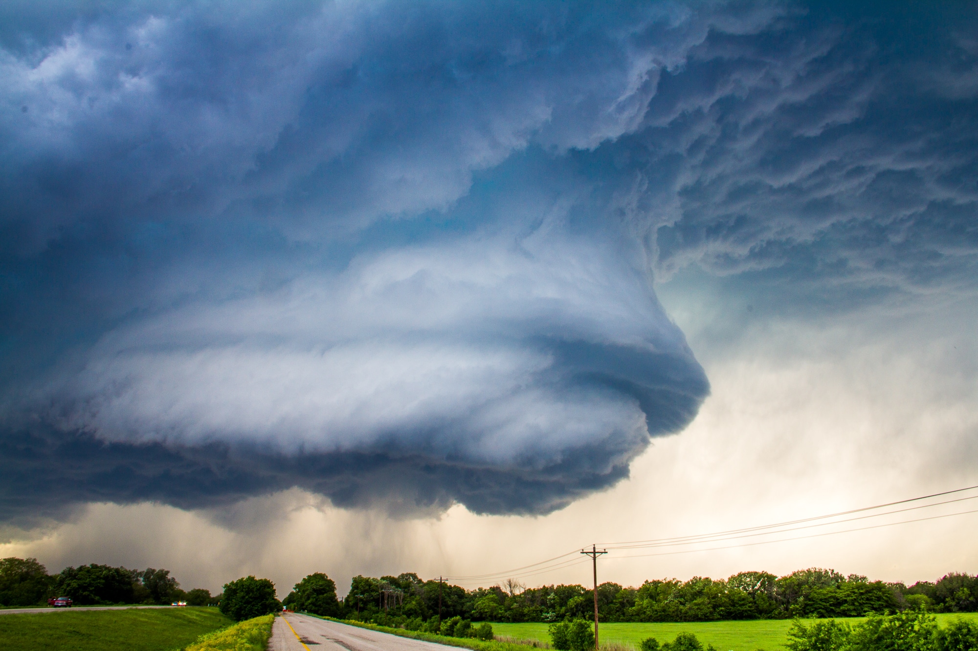
An amazing mesocyclone structure presented itself. I really thought a tornado was possible, so I pushed through Dublin and east.
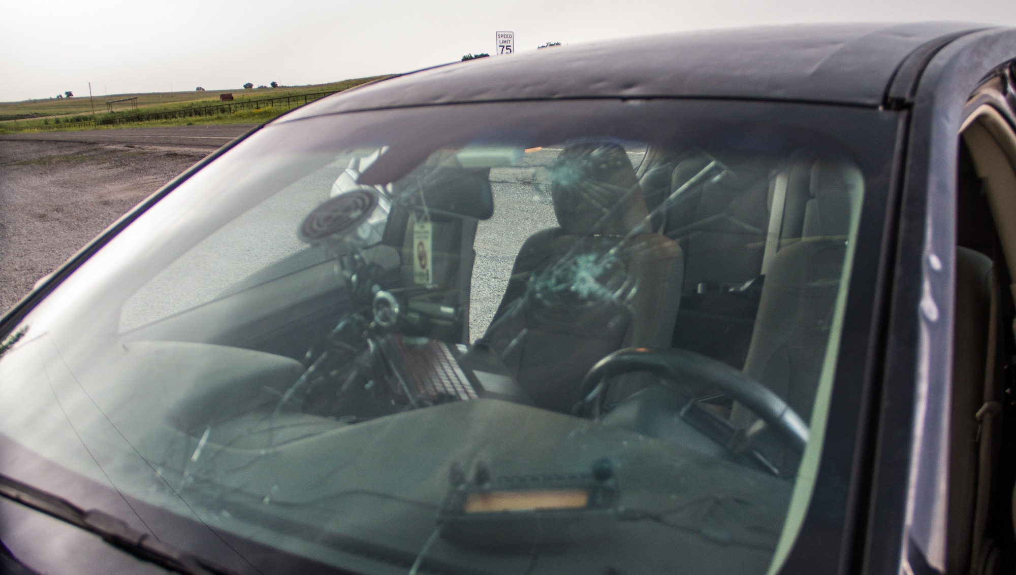
Big Hail
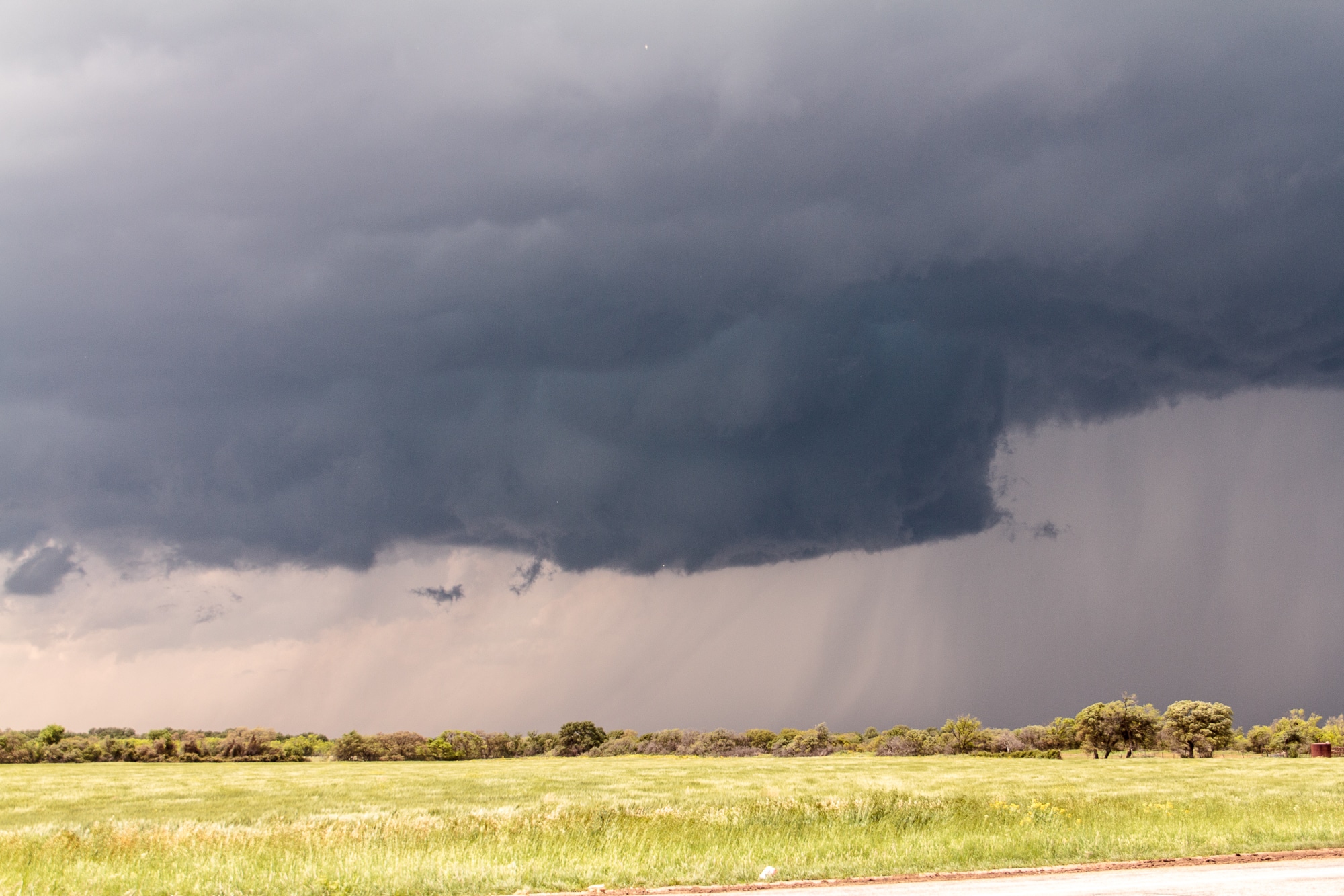
Unfortunately, I encountered some very large hail (baseball sized) and lost my windshield. As I headed east, I finally got out of the hail, and saw some amazing structure.
I continued east to Hico, continuing with the structure show. Grabbed a few amazing photos before deciding to drop back to storms forming to the west.

Dublin Hail
As we got into Dublin again, we were in extremely cold surface air and even hail fog. Incredible amounts of hail had fallen all around the area.
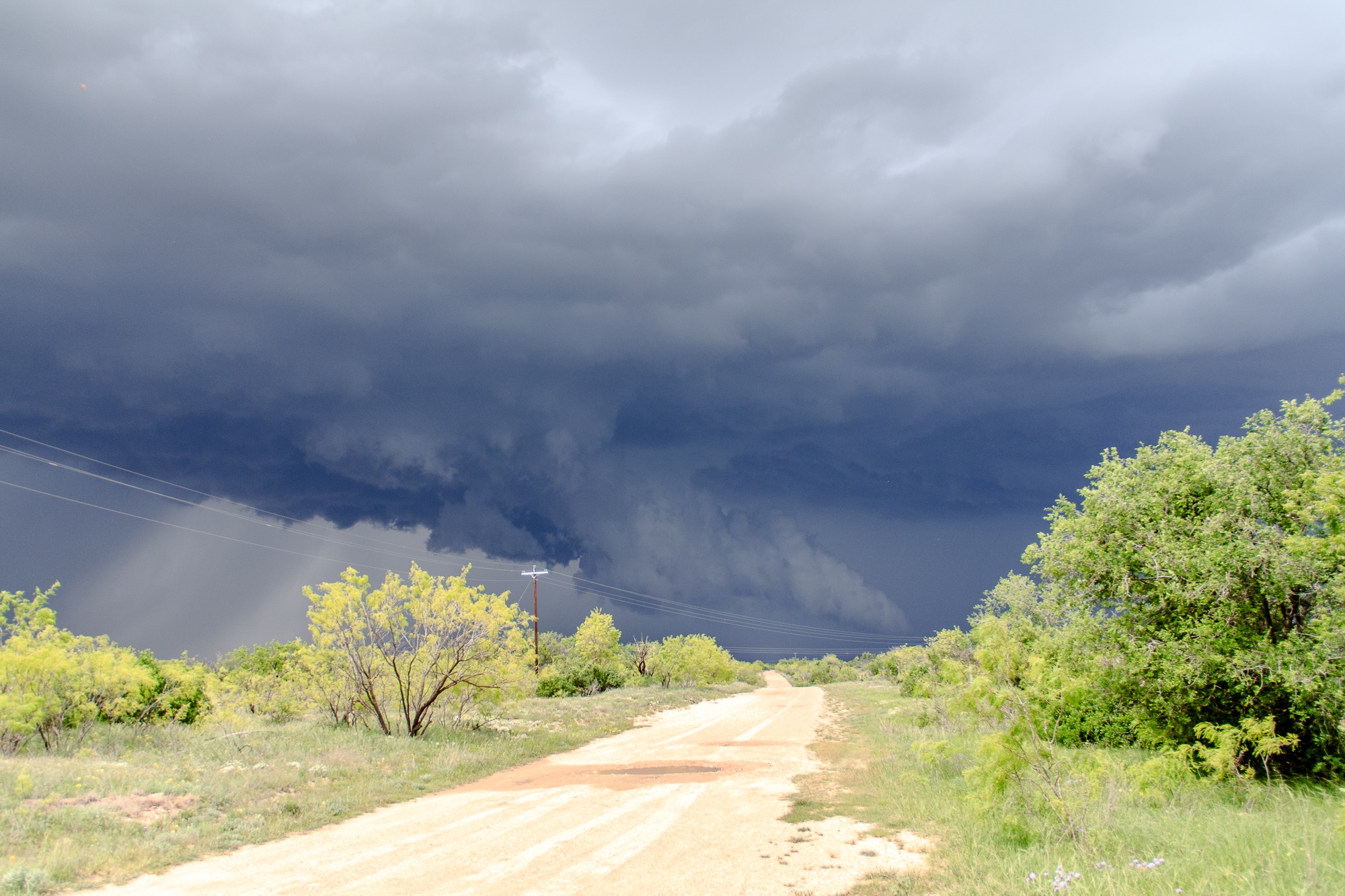
Stephenville, Texas Tornado
As I continued northeast towards Stephenville, I encountered a brief very weak tornado just to the side of the road. It was very non photogenic and passed behind my vehicle.
Cone Tornado
I followed the storm southeast on highway 67 before heading north on FM2481. The storm did not have a very focused updraft, and I ended up looking at 3 wall clouds at one point, all from 3 different occlusions. One of those occlusions produced a nice white cone tornado from our vantage point. Most of the people on the storm were off to the east enjoying the structure and missed it.
Back West
We again dropped southwest to Stephenville and further southwest. I ha run into JR Hehnly, Jeff Piotrowski and Adam Lucio. The rest of the evening would be spent on this dominant supercell which cycled many times as it went through Erath, Somerville and Johnson counties.
Cleburne State Park
Well after dark in Johnson county, we dropped south out of the rain and encountered some more hail. I also observed a night time tornado near Cleburne State Park. It was extremely hard to continue threading the needle so we eventually headed back up towards US67 and headed into Cleburne.
Calling it
While more tornadoes were ongoing, we decided to call the chase and head to Buffalo Wild Wings just up the road in Fort Worth before heading home, arrivning back in Norman around 330 am.


