Storm Chase Details
Miles Logged: 300
States Chased: MI
Spotter Network Reports: 3
Severe Risks: SPC Outlooks
Severe Reports: Storm Reports
I had been eying the potential for Severe Weather for a couple days, but had mostly expected a severe squall line which is oh so typical in Michigan. That’s pretty much what we got.
The lack of overall winds (30 knots at 500mb, 30 at 850) worried me. I figured we wouldn’t see very widespread damage, just enough to shake the trees loose of a few branches. Overall, that is what we had.
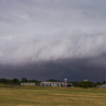
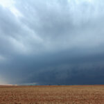
The sun came out early in the day, and destabilized lower Michigan adequately. We had 2500J/KG of SBCAPE present per mesoanalysis when things started firing around 2pm. I had a 2pm meeting at work, then headed out around 2:45, heading down 496 then north on US127.
The first cell that looked the best at the time was near Alma in Gratiot county. That was the one I targeted and stayed behind most of the day.
I took 127 up to M-46 and took that east, following behind the storm. As I got to the storm near St. Louis, it pretty much had died right off, with a VIL down to 19. Lightning started becoming more intense and the scans following showed a decent pulse up, but I got stuck behind a tractor going 20 mph for a number of miles and was unable to get by them.
I followed M46 to Hemlock where I started finding tree trash and small branches down (2 inches in diameter and less). I eventually headed north to Tittabawassee Rd, encountering a number of bigger branches down including a branch about 6″ in diameter which was down blocking part of the road.
Traffic wasn’t too bad along Tittabawassee through Saginaw. I got on 675 north to 75 south and went over the Zilwaukee Bridge before taking M81 east. I managed to get back to the storm and was following right behind it as I went through Reese. Another 6″ branch down in the road in Reese.
I took M81 all the way to Caro without finding anything more, and then took a side road due east for a number of miles until I encountered M53. I took M53 south, while catching up with the leading edge of the now well formed squall line. Traffic was slow, so I decided to bail east again along a dirt road and got back ahead of the leading edge of the front.
I got my anemometer out finally and recorded winds to about 33 as things passed over me.
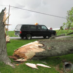
I headed south on M19 through the town of Yale where a 2 1/2 foot in diameter tree had fallen into the road. This was the biggest and last damage I’d see as I pretty much called it at this point. Storms were moving off shore and into Lake Huron and Canada.
I took M19 south to I-69 and headed back towards Lansing with a Sonic stop in Flint.


